


Airport Ownership and Management from official FAA records
Loc | Ops | Rwys | IFR | FBO | Links
Com | Nav | Svcs | Stats | Notes
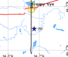
Road maps at:
MapQuest
Bing
Google
| Aerial photo | WARNING: Photo may not be current or correct 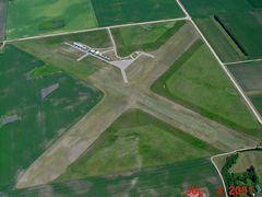 Do you have a better or more recent aerial photo of Sleepy Eye Municipal Airport that you would like to share? If so, please send us your photo. |
|---|

| Sectional chart | 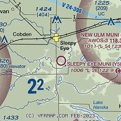 |
|---|


| Airport distance calculator |
|---|
| Sunrise and sunset | Times for 02-May-2023
|
|---|
| Current date and time |
|
|---|
| METAR |
|
|---|
| TAF |
|
|---|
y58
| NOTAMs |
NOTAMs are issued by the DoD/FAA and will open in a separate window not controlled by y58 AirNav.y58 y58 |
|---|
